
- Business
- Sustainability
- Innovation
- Institutional
-
Multimedia

Press

Editorials


Multimedia
Multimedia
Press

Published in 30/11/2023 at 16:40:35
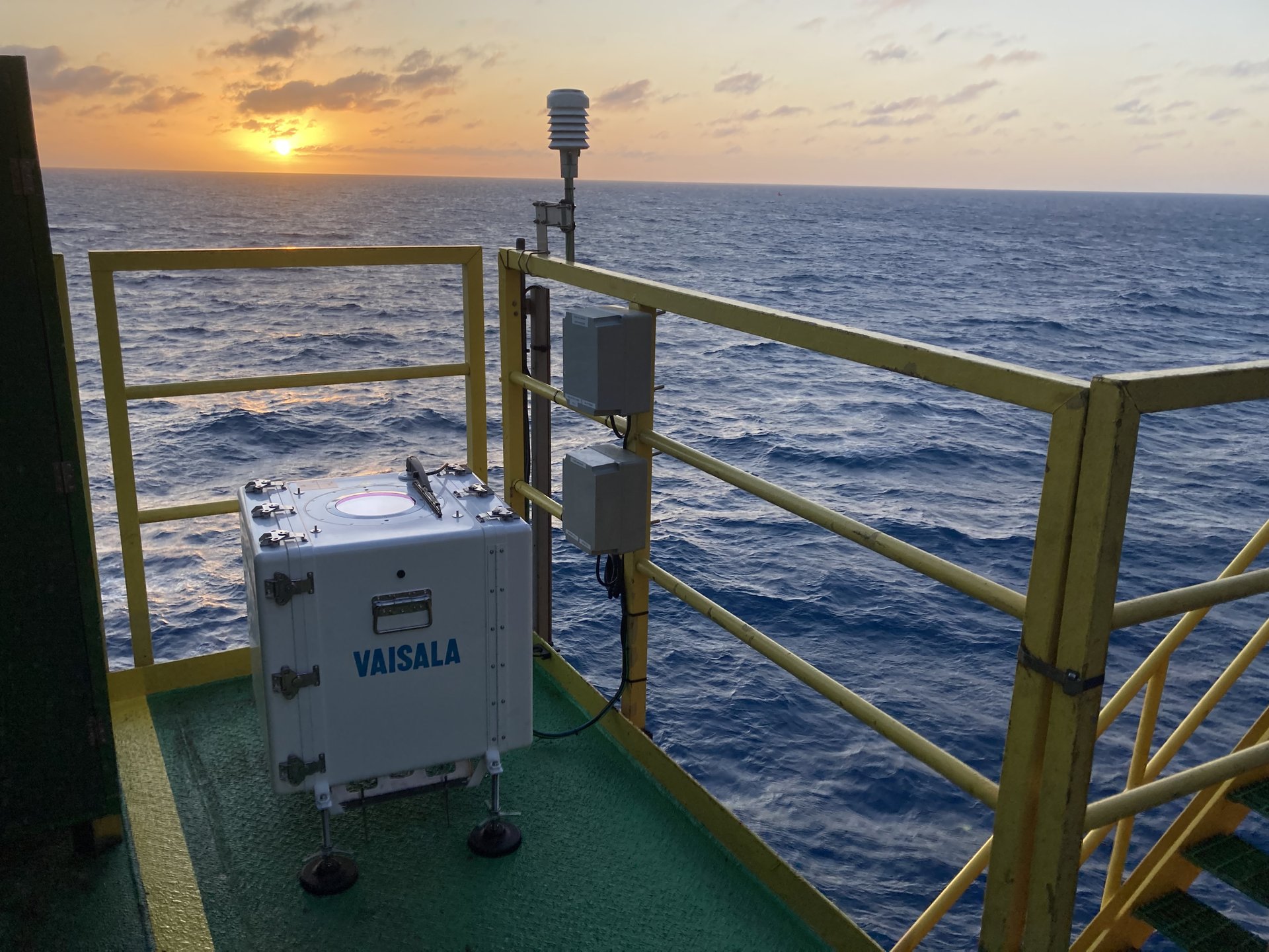
Petrobras installs sensor for wind measurements in the Pescada field (RN)
Photo: Divulgação
Download

Petrobras installed a LiDAR (Light Detection and Ranging) sensor on the PPE-1A platform, in the Pescada field (RN). This is the state’s second platform to have sensors installed to measure speed and wind direction, among other weather variables. Studies that have been conducted are essential for the implementation of offshore wind projects, as the company plans to install a total of 6 LiDARs in the states of Rio Grande do Norte, Ceará and Espírito Santo. The LiDAR optical sensor uses laser beams to measure wind speed and direction, from 10 to 300 meters above ground. The data that are generated are compatible with the wind turbines' operating environment.
“Deploying sensors on our platforms accelerates the process and lowers costs for mapping the wind potential of the selected region. The data obtained from these campaigns, in turn, will be used in decision-making on the implementation of projects”, says the director of Energy Transition and Sustainability at Petrobras, Maurício Tolmasquim.
The LIDAR sensors will be powered by photovoltaic modules or the platforms' own energy systems.
As per José Carlos Travassos, Director of Engineering, Technology and Innovation, “These machines are integral to upcoming wind measurement campaigns set to be unfold in shallow waters over a span of 3 years.” He further notes that “Specialists have commenced data collection, which will be sent to our Research and Innovation Development Center, Cenpes. The results will enable a detailed evaluation of various regions of the country with high potential for the development of offshore wind farms.”
Research projects
The Pescada platform (PPE1-A) is a fixed jacket type, located in a water depth of 16 m and approximately 28 kilometers from the coast. It is the second platform to have the sensor installed, the first being the PAG-2 fixed platform, in the Agulha field, late in August.
Since 2020, a LiDAR campaign has been underway on the Autonomous Pumping Platform (PRA-1), in the Campos Basin. PRA-1 is positioned approximately 100 m deep, 90 km from the coast. Measurements at PRA-1 will help specialists have a comprehensive understanding of the long-term wind characteristics in a region closely aligned with the company's Exploration and Production activities, offering numerous synergies.
At the same time, Petrobras has been working on a novel technology to measure winds in Brazil, at its research center, the Offshore Remote Wind Assessment Buoy (Bravo), in partnership with SENAI/ISI-ER and SENAI/ISI-SE.
 Photos


Use of this material is authorized for editorial purposes only.